 Filter: Categories of Wisconsin Historical Images
Filter: FORMAT_DIMENSIONS of 45 x 61 cm
Filter: Categories of Wisconsin Historical Images
Filter: FORMAT_DIMENSIONS of 45 x 61 cm

| Date: | 1909 |
|---|---|
| Description: | A brochure with a map showing the North-Western Railway lines from northern Illinois, starting at Chicago, to southeastern Wisconsin, stopping at Sheboygan... |

| Date: | 1937 |
|---|---|
| Description: | Includes points of interests in Madison and on the University of Wisconsin-Madison campus. Includes list of presidents of University of Wisconsin, 1849-193... |
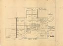
| Date: | 1949 |
|---|---|
| Description: | This map is ink and pencil on paper and shows land ownership by name, years of purchase, and city limits. Also included on the right and bottom margins are... |

| Date: | 1900 |
|---|---|
| Description: | This map shows the boundary lines between ceded and unceded land in compliance with the Treaty of Prairie du Chen of 1829. It also shows roads, rivers, por... |

| Date: | 1940 |
|---|---|
| Description: | This map shows a canoe route from Madison to Milwaukee, with total mileage of 237 miles. Includes proposed 1837 route of Milwaukee-Rock River Canal approv... |

| Date: | 1940 |
|---|---|
| Description: | This map shows a canoe route between Madison and Milwaukee. Includes text and an inset map of the route from Milwaukee to Madison. Shows the area around We... |
If you didn't find the material you searched for, our Library Reference Staff can help.
Call our reference desk at 608-264-6535 or email us at: